Pipe Dream
2014
Montreal and Portland, Maine are connected by an oil pipeline that runs 3 feet underground for 236 miles. Currently, crude oil arrives by ship in South Portland and travels west to Montreal for processing in a refinery. A controversial proposal would extend the line to the Alberta tar sands, reversing the flow and sending tar sands oil east to South Portland for export. South Portland residents have protested the move, and the use of tar sands oil in general has been referred to by James Hansen of NASA as "game over for the climate."
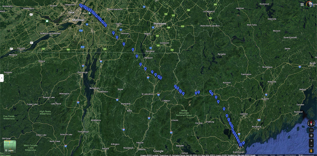
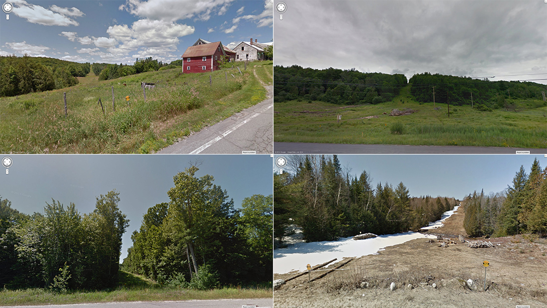
In this piece, I traced the pathway of the existing Montreal-Portland pipeline using satellite imagery from Google Maps. Though the pipeline is underground, a fine line appears in areas where tree cover has been removed from the pipeline's pathway. Under farms, it is virtually invisible, but I was able to guess by looking midway between the points I did know, and also relied on local, anecdotal resources online (for instance, a blog that identified the green right-of-way on a certain side of town as the pipeline area). It would have been impossible to confirm these points without the fact that crossings are typically indicated by small yellow signs – rectangles in Canada, circles in the US – reading "WARNING: CRUDE OIL" and with a phone number to call "before excavating or in an emergency." I then collected screen shots from Google StreetView of places where the pipeline crosses under the road.

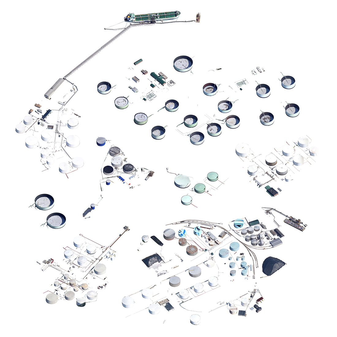
The resulting slideshow includes as many crossings of the Portland-Montreal pipeline under a road on StreetView that I was able to find. The soundtrack is a song by Jerry Reed, "Crude Oil Blues," slowed down and reversed. I created this video for a solo exhibition at SPACE Gallery in Portland, Maine, where it was accompanied by a print collecting oil drums from the tank farms in South Portland, cut out from Google Maps satellite imagery.